DEAIS: Going back in time with the Antarctic Ice Sheet
Scientists are going back in time near Princess Elisabeth to try and understand the global implications of a changing Eastern Antarctic Ice Sheet
Background
Images of large glaciers breaking off the Antarctic have been stirring up quite a bit of attention recently. These events are not only impressive to see, but have also provoked questions and concern around the world about how fast these changes are happening and how they may impact future global sea level rise in the face of climate change.
At the moment, we only have satellite measurements from over a few decades which give us a rather narrow picture of how the Antarctic Ice Sheet behaves over time. We do know that dramatic lowering of the surface of the East Antarctic Ice Sheet has occurred during the last million years, but there are other important aspects we know almost nothing about.
The DEAIS Project
The only way to get a clearer idea of how the Antarctic Ice Sheet will behave in the future and how it may impact future sea-level change is if we have information stretching over longer periods of time.
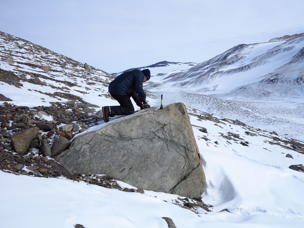
Scientists Dr. Naki Akçar and Dr. Serdar Yeşilyurt are now stationed at Princess Elisabeth exactly for this purpose. Their project DEAIS will help decipher the pace of deglaciation in the past as well as the long-term behavior of the Antarctic Ice Sheet in the Sør Rondane Mountains in Queen Maud Land.
Part of their work involves visiting nunatacks south and west of Princess Elisabeth station. A nunatack is an often rocky and exposed part of a ridge or mountain within or at the edge of a glacier or ice field. They plan to locate and map the paleo-positions and glacial retreat of ice margins found in these nunatacks. They will also analyze rock samples they collect from glacial deposits and glacially abraded bedrock at the study sites.
Why conduct research at Princess Elisabeth?
"First of all, the Sor Rondane Mountains remain largely unexplored and unstudied. Secondly, Princess Elisabeth’s location is perfect. It's found between the high ice plateau and lowlands to the north, and mountains are quite close. Scientists can access most study sites easily during daily trips without having to organize long difficult expeditions. A bonus is that the logistical standards offered at the station are very high which allows for top quality field research." Dr. Naki Akçar
Naki and Serdar’s work will give us insight into the deglaciation history and amount of sub-glacial erosion that has occurred in the region. But on a global scale, this knowledge will give us a better picture of how a changing Eastern Antarctic Ice Sheet will impact the world in the future.
Meet the DEAIS Team
Dr. Naki Akçar is a sedimentologist and stratigrapher based at the University of Bern. He teaches sedimentary petrography, sedimentology, geological and geomorphological mapping. He is especially keen about exploring the interactions occuring between the geosphere, climate and human societies during the Quaternary (last 2.6 million years of the Earth’s history) through the study of geological archives. He tries to solve this puzzle by producing quantitative sedimentological and chronological data from conducting field studies, quantitative methods in the lab, time calibration with cosmogenic nuclide chronologies, and modeling. This knowledge allows him to reconstruct and build the basis for assessing the causes and rates of landscape evolution over time.
Dr. Serdar Yeşilyurt is a geographer and geomorphologist who recently finished his PhD studies at the Physical Geography Division the Ankara University. His research interest is Quaternary landscapes, especially glacial morphology. In 2014, he was awarded an international intra-PhD grant by the Scientific and Technological Research Council of Turkey for scientific training at the Institute of Geological Sciences at the University of Bern. His key activities include contributing to state-of-the-art research projects as well as involvement in the management of a high-quality research laboratory and supervision of graduate students and teaching. He applies unmanned aerial vehicle (drone) technologies for detailed mapping and compares collected data with existing aerial photographs.
Author: Lisa Benedetti